Heritage Ponds Project
Heritage Ponds Project
Ceri Pennington
Project background
Between 2024 and 2026, the Heritage Conservation team at Kent County Council worked with the Kent Downs National Landscape team on the Heritage Ponds project (funded by the Farming in Protected Landscapes programme and the National Lottery Heritage Fund). This project aimed to record historic (pre-1900 AD) ponds on the Kent Downs to identify a select number with the potential for wildlife-focused restoration.
Ponds have historically had many functions, including agricultural, industrial, and ornamental. They are important features within the landscape and hold significant value in terms of their use, and as part of their wider cultural and historical contexts. Ponds are also important because of the benefits which they can provide for wildlife, including protected species.
Around 75% of ponds have been lost in the last century due to changing agricultural practices. Many of these features were important habitats and water sources which are now no longer available for wildlife. ‘Ghost ponds’ (see figure 1) are ponds which no longer hold water, but which still exist as visible features in the landscape. For example, depressions in agricultural fields often contain the dormant seeds of aquatic plants, so when they are restored, plant species can re-establish and lost habitats can be recovered. This project focused on identifying ghost ponds with the greatest potential for wildlife focused restoration. The ponds selected for restoration were chosen to alleviate both a lack of water and habitat in their wider landscapes, and to mitigate some of the effects of climate change, including the potential for increased periods of drought in future years.
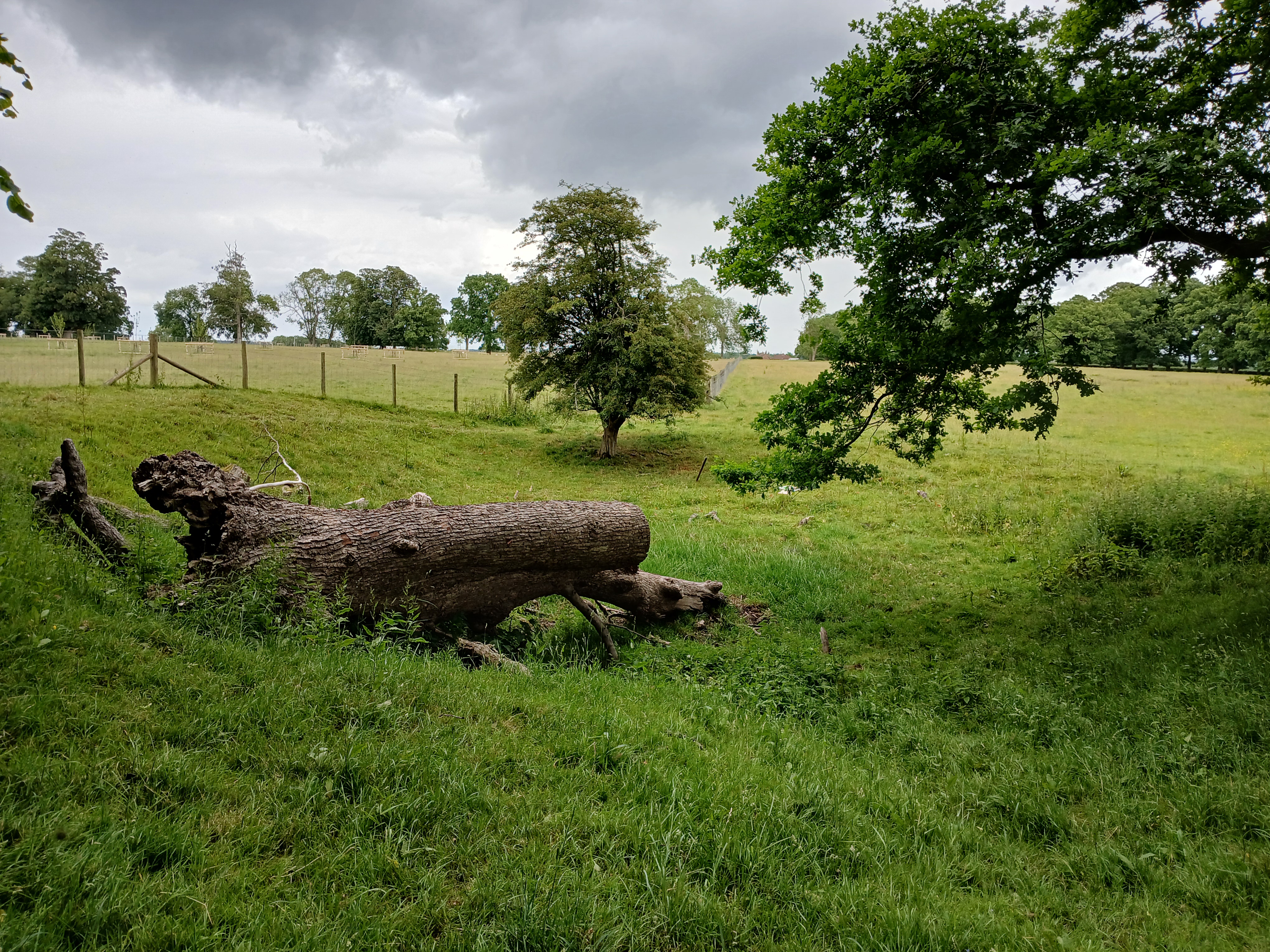
Figure 1. ‘Ghost pond’ at Otterden Place (image credit Kent Downs National Landscape).
Identifying the ponds
The first stage of the project involved 55 volunteers working with the Kent Downs team to map historic ponds on the Kent LiDAR Portal. The volunteers used a combination of Historic OS (Ordnance Survey) maps dating back to c. 1862-1875 AD and LiDAR (Light Detection and Ranging) data to locate ponds on the LiDAR portal. The ponds were then mapped with GIS polygon depictions, and a record was created of the feature.
These records were uploaded onto the Kent HER (Historic Environment Record) through several imports carried out over the course of the project. During the project, records of over 1,600 ponds were imported to the Kent HER. A number of these records were enhanced with further information recorded during site visits and investigations carried out by the Kent Downs team, the Kent Countryside Management Partnerships, and archaeological contractors as part of later phases of the project.
Archaeological investigations
During the project, the Kent Downs team carried out visits to a number of sites to determine their suitability for restoration. Field visits revealed features such as earthworks and trackways not previously recorded on the HER, which provided information to enhance the database and build up a clearer picture of the site’s development and its wider context.
Alongside the field visits, a small number of sites considered to have the greatest potential for restoration underwent further investigation carried out by archaeological contractors (Archaeology South-East, Canterbury Archaeological Trust, and Wessex Archaeology). Ponds frequently contain waterlogged and anoxic/anaerobic (oxygen depleted) deposits which can preserve organic material like plant remains, many of which continue to be preserved once the features become ‘ghost ponds’.
Auger surveys were carried out at 24 selected ponds. The surveys involved drilling a hollow metal tube through the pond sediments (often through the base and/or the bank of the feature) and extracting core soil samples which were analysed to build up a picture of the stratigraphic sequence of deposit layers. This could provide information on the origin and date of the pond, the construction materials used to create it, and sites and activities taking place nearby. Charcoal could indicate local burning events, pottery could be evidence of domestic activity, and ceramic building material could relate to a construction or demolition event.
Typology of historic ponds
Different types of ponds and historic water features include, but are not limited to, fishponds, mill ponds, moats, lakes, ornamental ponds, duck ponds, ponds formed in quarry pits, and dew and sole ponds. The latter two types of ponds were the focus for this project as these are frequently established for agricultural functions (see figure 2) so many have been recently lost from the landscape and are often located in areas beneficial for biodiversity.
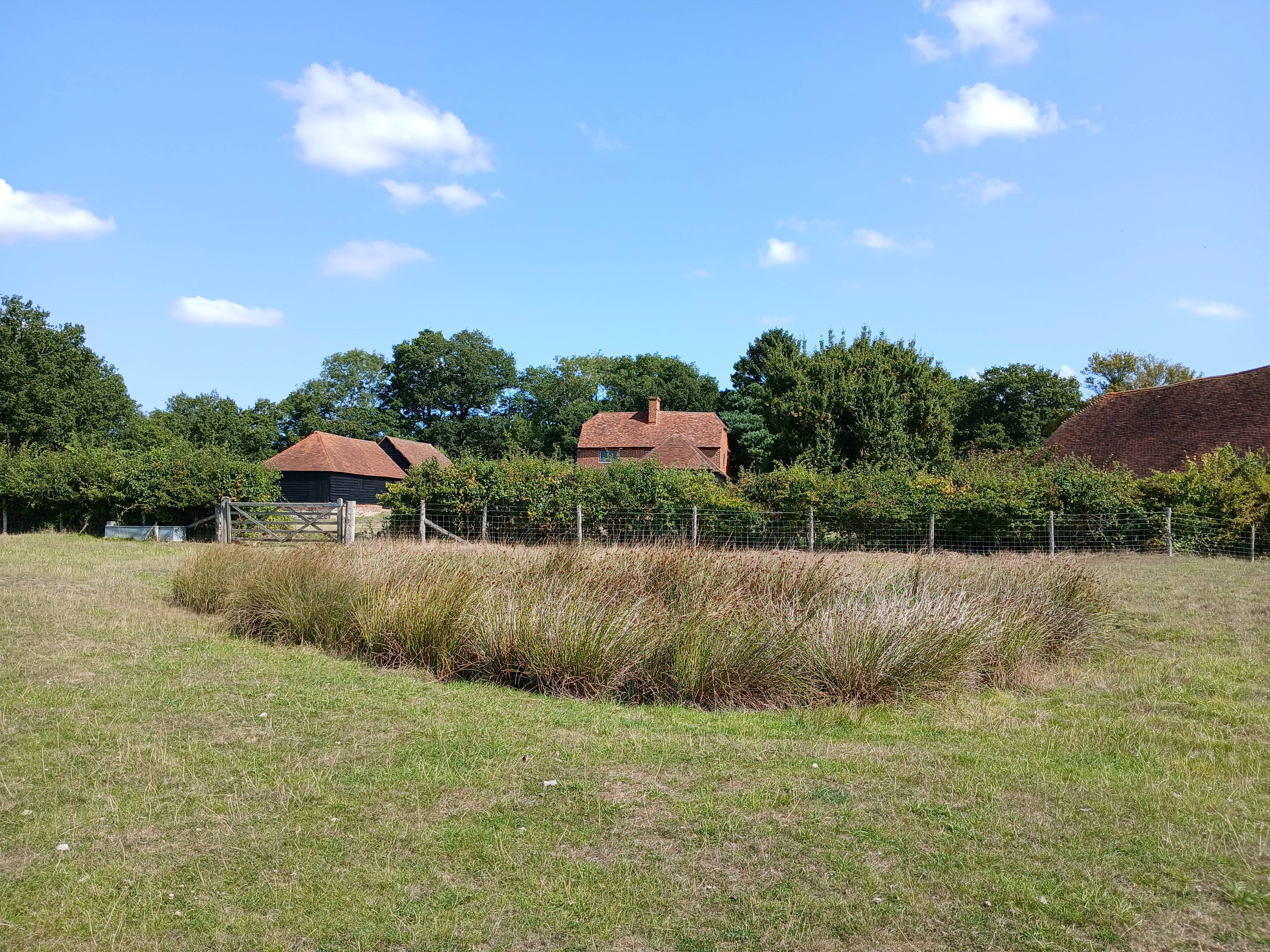
Figure 2. A pond in an agricultural setting, associated with farm buildings (image credit Kent Downs National Landscape).
Assessing the typology of different ponds can prove difficult as some ponds have multiple functions. For example, a fishpond could be both a place for breeding and holding fish but could also exist as an ornamental pond. Many ponds may also change in function over their lifetimes, such as a pond formed in a quarry pit which later developed into a feature used for watering livestock. Ponds may be associated with historic features, which can help to identify previously unrecorded heritage sites, and can be useful for locating further historic ponds.
Dew and sole ponds
Dew ponds (see figure 3) and sole ponds are frequently established for agricultural purposes and are predominantly used for watering livestock. They are often located in hill settings, differentiated by their underlying geologies. Dew ponds are associated with chalk hill geologies and sole ponds with more clayey geologies. Over 670 dew/sole ponds were identified by volunteers during the Heritage Ponds project, making up over one third of all the ponds catalogued.
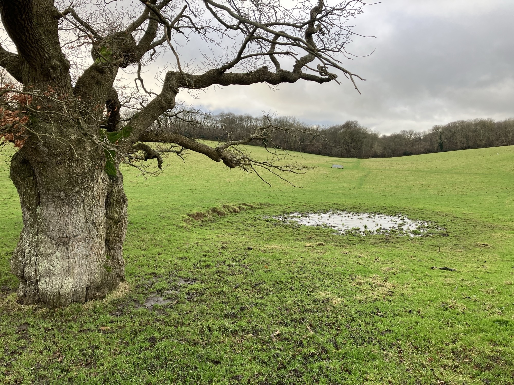
Figure 3. Dew pond near Acrise Place (image credit Kent Downs National Landscape).
As dew/sole ponds are often sited in otherwise relatively water-scarce landscapes, they can make excellent candidates for restoration. Data recovered from investigations of these features can reveal information on landscape development over the pond’s lifespan, including the habitat of the pond itself, the species associated with it, and the wider landscape context, for example, woodland, grassland, or wetland conditions. In one example, a sole pond identified at Eggringe Wood underwent an auger survey which revealed that it was historically located in a woodland environment composed of hornbeam, beech, and birch.
Fishponds
Fishponds comprise a pond or series of ponds designed for breeding and holding fish. Fishponds are known to have existed in England since the Roman period; however, they are most frequently dated to the medieval, post-medieval, and modern periods. During medieval and earlier periods, fishponds would have had a primarily practical function, as a food-production facility for settlements, monasteries, or high-status residences. An example of this is a fish pond located in the grounds of Boxley Abbey which probably supplied fish to the abbey during the medieval period. Fish which were farmed in this way during the medieval period included eel, bream, and perch. During later periods, fishponds may have taken on a more ornamental function at some sites, although a large number are still used for fishing today.
Ornamental ponds
Ornamental ponds are often found in high status settings, such as country estates and designed landscapes. However, ornamental ponds may also be located in village settings or associated with private residences. In some cases, ornamental ponds can have several functions, for example as duck and fishponds. Many ponds and lakes began to be associated with ornamental features like cascades and fountains during the post-medieval and modern periods.
During a field visit carried out at one of the sites, a feature previously identified from map and LiDAR evidence as a pond formed in a disused quarry pit was reinterpreted as potentially originating as an ornamental feature associated with Evington Place Country House. The pond was in close proximity to a planned avenue leading to the house and, during the auger survey, material consistent with demolition deposits was identified in pond sediments, potentially relating to the later destruction of the building.
Mill ponds
Mill ponds are associated with water-powered mills and often formed part of the wider infrastructure of villages and towns. Water-powered mills are known to have existed since the Roman period but are recorded with increasing frequency from the medieval period into the early 20th century.
Water-powered mills used the flow of a river or a stream of water, sometimes controlled by a sluice and a series of channels, to turn a water wheel attached to machinery inside the mill. Many were corn mills used to grind flour, however, other types of mills which could be water-powered included sawmills, paper mills, textile mills, and fulling mills. As most water-powered mills went out of use during the 20th century due to increased industrialisation, the associated mill ponds were sometimes reused for other functions and remained in the landscape as fishponds or duck ponds.
An example of a mill pond can be found on the eastern edge of Squerryes Court Park in Westerham. The pond is associated with a corn mill (Elm View Mill) located to the north of the site which fell out of use at some point between 1865 and 1900 AD. The pond appears on aerial photography and modern OS mapping of the site, so probably still exists today. The HER record for Squerryes Court Park states that a series of ponds on the north east boundary of the park, which originally functioned as mill ponds, were restored during the mid-20th century, and, at the beginning of the 21st century, were used for trout fishing.
Former quarry pits
Ponds in quarry pits form from water pooling in depressions in the ground created as a result of quarrying for natural materials. Material like flint was excavated during prehistory, and was utilized in the production of stone tools, and later, during the medieval period, in the construction of walls. Many quarries located during this project are likely to have been established during the medieval and post-medieval periods as a source for materials like chalk, stone, and clay to be used for the construction of buildings and in various industries.
Many disused quarry pits across the Kent Downs were established for chalk and clay extraction. Chalk has been associated with the production of lime since the Roman period and chalk pits are often located near to the site of lime kilns. An example of this is a post-medieval pond identified as a former quarry pit in Chiddingstone. This feature is not labelled on the OS maps but its appearance suggests it originally functioned as a quarry pit, and it is located next to a post-medieval lime kiln which strengthens this interpretation.
Dating the ponds
The majority of ponds identified during the project were initially recorded as post-medieval in date, established at some point between 1540 and 1900 AD. The historic OS maps used for the identification of the ponds date from as far back as the mid-19th century, therefore, the majority of the features were given tentative dates of 1862 AD or 1897 AD, reflecting the earliest date of the 1st edition and 2nd edition OS maps. During a review of historic ponds carried out after the initial identification phase, Tithe Maps dating back to around 1840 AD were also used to provide a more accurate date for some of the features. The HER records were updated accordingly. However, ponds visible on 19th and 20th century maps, and some still extant in the 21st century, may have medieval (or earlier) origins. One aspect which can make dating ponds challenging is that these features can form naturally in the landscape and may undergo anthropogenic (human affected) alterations during later periods, so their origins can be more challenging to establish.
Methods used to establish a clearer date for historic ponds include typological dating of artefacts recovered during intrusive investigation. This could include pottery fragments or coins recovered from pond sediments for which a date can be established, providing a rough date for the layer they derive from. Other dating methodologies include radiocarbon dating of sediments; future work on the project by the Kent Downs team and archaeological contractors will involve radiocarbon dating of samples recovered from the auger samples recovered from the 24 selected ponds.
Restoration
The Kent Downs National Landscape team has worked on the restoration of a pond at Cobham Wood near Randall Manor. This site was overgrown with vegetation and only held a small amount of water across the year. Restoration involved clearing the vegetation from the site, adapting the form of the pond to more effectively provide water and habitat for aquatic wildlife, and adding a bentonite liner (clay sandwiched between geotextile) to increase water retention. Further restoration works are planned for the other selected pond sites.
Project outcomes
The heritage ponds project mapped 1,654 ponds onto the Kent HER. Many of these records have been enhanced during the course of the project, and new features have been added to reflect the discoveries made during site visits, archaeological investigations, and desk-based study of historic mapping, aerial photography, and LiDAR imagery. A few of the ponds were already present as pre-existing records on the HER. However, the vast majority of pond records imported and enhanced during this project were not already present on the HER.
The restored ponds have been specifically selected to provide new habitat and resources for wildlife. Many of the restored ponds will especially benefit protected and endangered species, such as the turtle dove and the great crested newt. In some cases, these features will also hold significant community value. Many ghost ponds may have once been or may still be associated with local landmarks and hold communal value for residents of the local area.
The ponds have also provided value in terms of the information recovered from them during auger surveys and geoarchaeological investigations. The pond sediments can enhance our understanding of changing environments, of construction techniques, and, crucially, can in some cases reveal the date when the ponds were created, why they were created, and their changing functions over time. The information recovered through mapping and investigating the ponds will have the potential to inform our understanding of landscape development, historic construction practices, environmental change, and industrial archaeology.